This is a log of my adventure ascending Mount Semeru (3,676 meters) third highest peak in Indonesia after Puncak Jaya (4,884M) in Papua Province and Mount Kerinci (3,805M) in Sumatra.
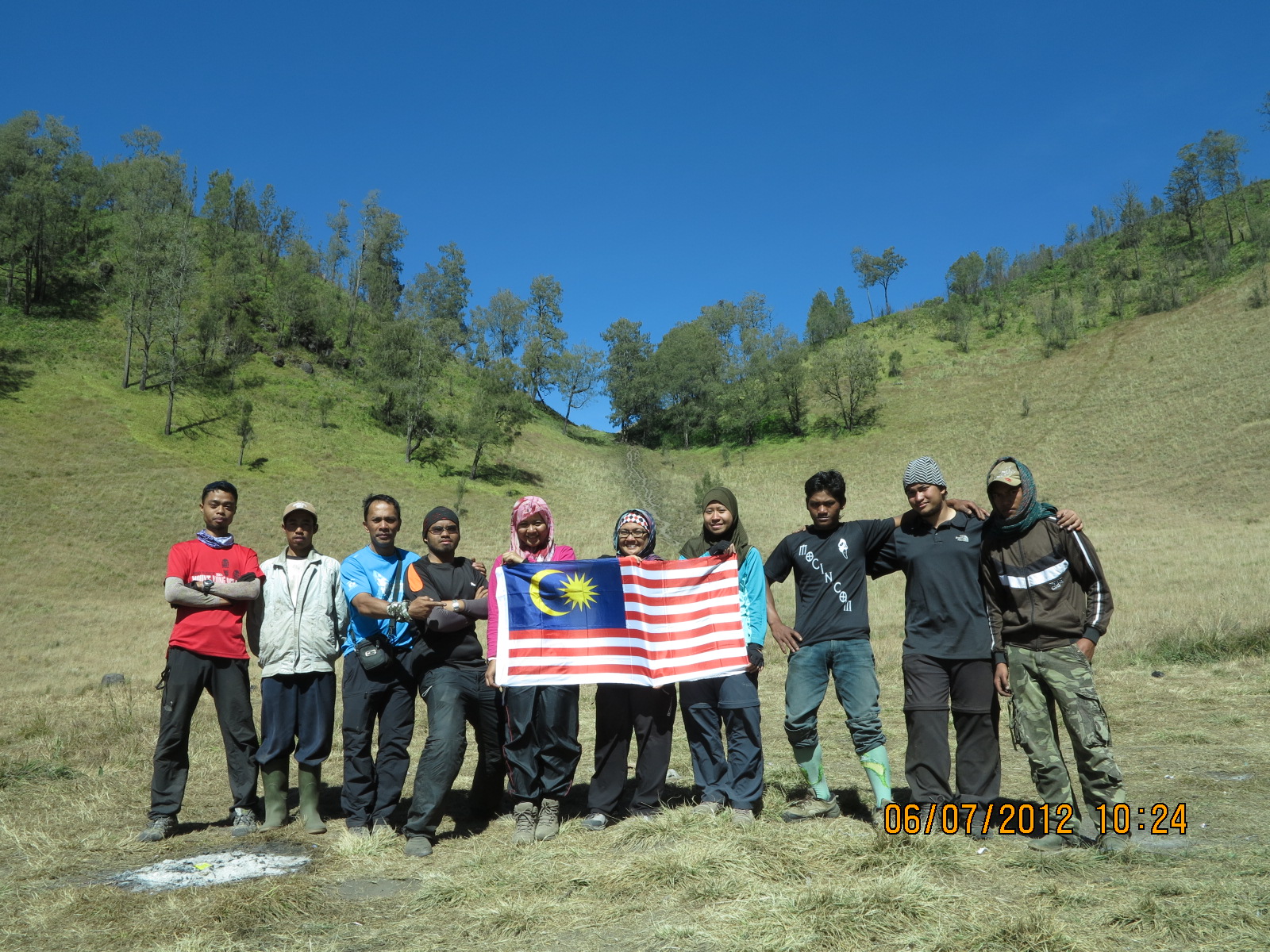
There are 10 of us in the group. From left to right in the pic below, Kerul Syukri, Shauqie Assegaf, Shahrizan (group leader), Kay Ma Haneul, Nor Zaitulailla and Cik Nomi (3 potters/guides and me - not in the pic).

We had our lunch at the hut in the picture below.


 Another reminder is ~ bring along a mask or something to cover your nose. Mount Semeru is a stratovolcano, which means it is built by volcanic ash. The ash on the ground is light and powdery in nature and will float up into your face and nose when the person in front of you walks over it.


There are 10 of us in the group. From left to right in the pic below, Kerul Syukri, Shauqie Assegaf, Shahrizan (group leader), Kay Ma Haneul, Nor Zaitulailla and Cik Nomi (3 potters/guides and me - not in the pic).

We were advised in advance to be prepared for a very cold night in Ranu Kumbolo and Kalimati (the base camp for Mt. Semeru). Thus, the heavy clothing you see in the pic. We started from Ranu Pane at about 6 am. The weather was good, cool and crispy. After a small briefing and warm-up lead by Shahrizan, we started our 4 hours trekking up to Ranu Kumbolo. This is a relatively easy ascend except for a few steep climbs. We reached Ranu Kumbolo just in time for lunch.
We had our lunch at the hut in the picture below.

Ranu Kumbolo is 2,400 meters above sea level an is situated within the Bromo Tengger Semeru National Park. Trekkers
who don't intend to climb up to Semeru will camp here. There is a beautiful lake - about 15 hectares in area. This lake is the only source of water here. Please
be considerate. Do not pollute the water! Answering nature's call must be done far-far away from the lake.


You can see above that I have taken off all the thick clothing as it's already noon (about 20 degree Celsius). We have trekked for more than 4 hours.

After lunch we had to continue trekking for another 2 hours to reach the base camp. This how the trail looks like. This is also the easy part of the climb. The landscape is undulating and the scenery is beautiful. I would recommend that you bring your camera with a huge memory card because you would be snapping non-stop. Don't forget to bring extra batteries as well.
 Another reminder is ~ bring along a mask or something to cover your nose. Mount Semeru is a stratovolcano, which means it is built by volcanic ash. The ash on the ground is light and powdery in nature and will float up into your face and nose when the person in front of you walks over it.
We reached Kalimati (2,700 meters) with about 3 hours daylight left and quickly pitched our tents for the night.


Water point is about 1/2 (half) hours walk from the camp site. So you may want to bring some water from Ranu Kumbolo lake to avoid having to walk the extra one hour (to and fro). By this time were all exhausted. We took some light meal and prepare to doze-off. 2 am will be the ascend to Mt. Semeru. This is the toughest part of the climb.
For Mt. Semeru
climbers, this is the starting point of the ascend. We

started our ascend at about 2 am and plan to reach the top at 5 am where we can catch the sunrise over the horizon. The peak of Mt. Semeru is called "Puncak Mahameru" by the locals. However, we were only able to reach the top at around 6.30 am. This is because we have underestimated the difficulty of the climb.
As mentioned earlier, Mt Semeru is a stratovolcano and is built from volcanic ash and lava strewn out from volcanic eruptions. The ground you step on is soft and unstable. For every three steps up you take, you tend to slide back two steps. You need to be on all-four if you don't have a walking stick.

I was lucky my son was here about a month earlier. He practically insisted that I bring two walking sticks. He is an Ultra Marathon runner and a triathlete; it took him 5 hours to reach the top. The walking stick helps a lot. I reached the peak in 4.30 hrs. Another thing you must have is - mental strength. You can see the peak but you just cannot reach it! You must have patient and determination to reach Puncak Mahameru.
The Crater at Puncak Mahameru is called "Jonggring Saloko" at a height of 3,744 meters. The crater spills lava on the South side. That is why the guide will not take you up from the South side of Mt. Semeru. The temperature at the top is around 0 - 4 degree Celsius. At night the temp would be around 3 - 8 degree Celsius for the surrounding area (including Kalimati) and 15 - 21 degree Celsius during the day.

That's me at the top of Puncak Mahameru and behind me is the Jonggring Saloko crater.
All of us with the 3 potters/guide

Happy people after a successful climb (peerahh)
wonderful trip, Mount Bromo Ijen Crater Tour Package
ReplyDeleteMount Bromo Tour Package East Java
Ijen Crater Tour Package
Mount Semeru Tour Package Climbing East Java Indonesia
Mount Bromo Midnight Tour Package One Day
Ijen Crater Blue Fire Tour Package East Java
Mount Semeru Mount Bromo Tour Package Trekking 4 Days
Mount Bromo Madakaripura Waterfall Tour Package
Mount Bromo Ijen Crater Tour Package 3 days 2 nights
Tour Package Surabaya Mount Bromo East Java Cheap Price